Top 10 Spain Map Resources for Your Next Adventure
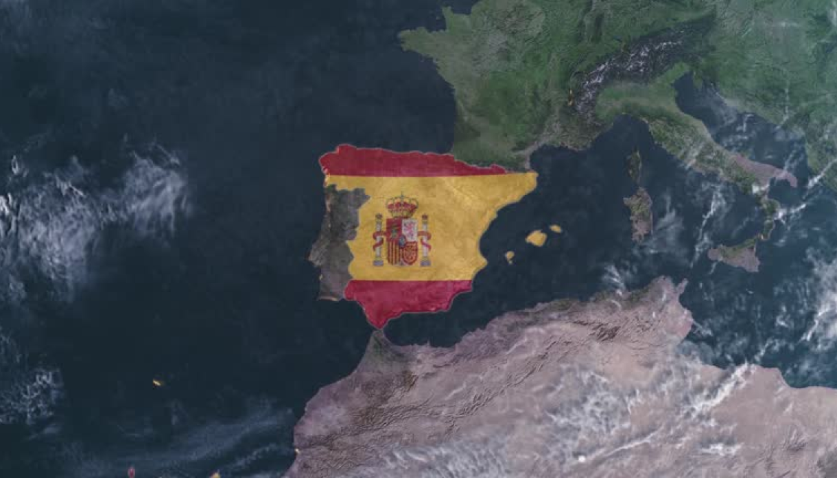
Spain is one of the most captivating destinations in Europe, offering a diverse blend of historical landmarks, stunning landscapes, and vibrant culture. Whether you are planning a road trip across the country or exploring specific regions like Catalonia, Andalusia, or Galicia, having the right map is essential for a smooth and enjoyable journey. While traditional paper maps have their charm, digital tools have revolutionized how travelers navigate. In this article, we’ll dive into the Top 10 Spain Map resources you shouldn’t miss for your next adventure, ranging from interactive maps to specialized tools that cater to various travel needs.
1. Google Maps: The Ultimate Spain Map for Navigation
Unsurprisingly, Google Maps tops the list as one of the most reliable and user-friendly map resources for Spain. Whether you are driving, walking, or using public transportation, Google Maps offers real-time updates, detailed route options, and even traffic conditions. With its satellite view, terrain features, and street view, you can explore Spain like never before. The app also includes information on businesses, restaurants, hotels, and attractions, making it a one-stop resource for both navigation and planning.
Benefits of Using Google Maps for Spain Travel
- Real-time traffic updates: Stay informed about road conditions and avoid congestion.
- Offline maps: Download specific areas in Spain to navigate without an internet connection.
- Public transportation integration: Google Maps provides bus, metro, and train schedules for major cities like Madrid and Barcelona.
- Walking and biking routes: Discover scenic walking paths or bike trails through Spain’s towns and countryside.
Google Maps is especially useful for planning road trips through Spain’s diverse regions, from the Pyrenees to the Mediterranean coast.
2. Michelin Maps: The Classic Road Trip Companion
Michelin Maps have been a trusted resource for travelers for decades, and their maps of Spain are no exception. Known for their detailed road maps and coverage of scenic routes, Michelin offers both paper and digital versions to suit every traveler’s preference. Michelin’s Spain Map series is renowned for marking out key points of interest, from cultural sites to natural landmarks, making it an excellent resource for those who prefer exploring Spain by car.
Why Choose Michelin Maps?
- Scenic routes: Michelin highlights beautiful driving routes, ideal for road trip enthusiasts.
- Detailed road network: The spain map cover everything from major highways to lesser-known local roads.
- Tourist attractions: Michelin Maps include cultural and historical landmarks, hotels, and restaurants.
- Elevation details: For those venturing into Spain’s mountainous areas, Michelin Maps show terrain and elevation changes, helping you plan accordingly.
Whether you’re driving through Andalusia’s white villages or exploring the wine regions of La Rioja, Michelin’s comprehensive road maps ensure you won’t miss a thing.
3. Komoot: Best Spain Map for Hiking and Cycling Enthusiasts
For adventure seekers who love hiking, trekking, or cycling, Komoot is the perfect map resource. This app specializes in outdoor navigation, offering detailed maps and routes tailored to hiking, mountain biking, and road cycling. Spain’s diverse terrain, from the Camino de Santiago in the north to the rugged trails of the Sierra Nevada, makes it an excellent destination for outdoor activities, and Komoot’s interactive maps provide everything you need to navigate these landscapes safely.
Features of Komoot for Spain
- Custom routes: Plan your own hiking or biking routes through Spain’s parks, mountains, and coastlines.
- Topographic maps: Get elevation details and terrain data to ensure you are prepared for the trail ahead.
- Offline functionality: Download maps for offline use in remote areas.
- Turn-by-turn navigation: Komoot provides audio guidance to keep you on track during your outdoor adventures.
Komoot’s community-driven platform allows users to share route recommendations, so you can discover new trails based on real experiences from fellow travelers.
4. Civitatis Spain Map: The Go-To for Tourists and Sightseers
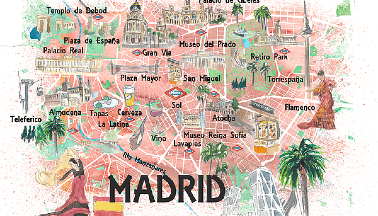
Civitatis offers one of the most user-friendly Spain Map resources for tourists looking to explore the country’s famous landmarks and cities. This platform is designed to help visitors find guided tours, skip-the-line tickets for attractions, and local experiences. The interactive map feature on their website is incredibly helpful for pinpointing key attractions in popular cities like Madrid, Barcelona, Seville, and Valencia.
What Makes Civitatis Stand Out?
- Tourist-focused: The map highlights major attractions, museums, and historical landmarks.
- Booking integration: Easily book guided tours, tickets, and activities through the platform.
- City guides: Civitatis provides detailed city maps with must-see spots, ideal for first-time visitors to Spain.
- Multilingual support: The app and website are available in multiple languages, catering to international tourists.
If your trip to Spain revolves around visiting iconic sites such as the Sagrada Familia, the Alhambra, or the Prado Museum, Civitatis is an indispensable map resource.
5. Spain Official Tourist Maps: Free and Comprehensive
For those who prefer traditional spain map, Spain’s official tourism website offers free downloadable Spain Map resources. These official maps are available in both print and digital formats, covering various aspects of the country, from regional spain map to city-specific ones. The maps are highly detailed and produced by Spain’s Ministry of Tourism, ensuring that they are up-to-date and accurate.
Advantages of Using Spain’s Official Maps
- Free of charge: Access high-quality maps at no cost.
- Wide coverage: Includes detailed maps of Spain’s regions, cities, and transportation networks.
- Tourist-centric: The maps are designed with tourists in mind, highlighting important sites and providing essential travel information.
- Updated regularly: Maps are maintained by official sources, so they are frequently updated.
These maps are particularly useful for travelers seeking reliable, government-sourced information without relying on third-party apps.
6. AllTrails: Ideal Spain Map for Nature Lovers
For outdoor enthusiasts looking to explore Spain’s natural beauty, AllTrails is another excellent map resource. The app provides access to thousands of hiking, walking, and running trails across Spain, with detailed maps and reviews from other users. Whether you’re trekking through the Picos de Europa or exploring the volcanic landscapes of the Canary Islands, AllTrails offers a vast collection of trail maps for every level of adventurer.
Key Features of AllTrails for Spain
- Trail variety: Discover trails for hiking, biking, and even off-road driving.
- Community feedback: Read reviews and get recommendations from fellow travelers.
- Customizable maps: Filter maps by difficulty, distance, and elevation.
- Safety features: AllTrails includes safety information, such as the best times to visit and potential hazards along trails.
With Spain’s varied geography, including coastal paths, mountains, and deserts, AllTrails helps nature lovers find the best outdoor experiences.
7. OpenStreetMap: The Free and Open-Source Spain Map
OpenStreetMap (OSM) is a community-driven map resource that provides detailed information for locations worldwide, including Spain. What sets OpenStreetMap apart is its open-source nature, allowing users to contribute and edit the map data, which often results in highly detailed and accurate maps. It’s particularly valuable for travelers seeking up-to-date information on less-touristy areas, such as rural regions or small towns in Spain.
Why Use OpenStreetMap in Spain?
- Customizable layers: Choose from various map layers, including cycling paths, hiking trails, and public transportation routes.
- User contributions: Local users frequently update the maps, ensuring accuracy even in remote areas.
- Offline use: Download specific areas of Spain for offline navigation.
- Free to use: Access the platform without any costs or subscriptions.
OpenStreetMap is particularly useful for adventurous travelers who want to explore off-the-beaten-path destinations in Spain.
8. Spain Travel Guide Apps with Integrated Maps
Several Spain-specific travel guide apps offer integrated maps, combining tourist information with navigation tools. Apps like Spain Travel Guide by Triposo and Spain Guide by TripHobo offer detailed spain maps that highlight attractions, restaurants, hotels, and more, allowing you to plan and navigate your journey in one place.
Benefits of These Apps
- Comprehensive travel info: Access local insights, cultural tips, and travel itineraries alongside the map.
- Offline maps: Many of these apps offer offline map functionality, which is essential for travelers without constant internet access.
- Customization: Create custom routes based on your interests, whether you’re looking for historical sites, beaches, or nightlife.
- User-friendly interface: Designed for tourists, these apps are easy to navigate and packed with relevant information.
These apps are particularly beneficial for travelers who prefer to have all their travel resources in one place.
9. HERE WeGo: The Best Offline Spain Map for Travelers
HERE WeGo is a great alternative to Google Maps for travelers seeking offline navigation. This map app allows you to download entire countries, including Spain, for offline use, making it a popular choice for those traveling to areas with limited internet access.
Why Use HERE WeGo for Spain?
- Offline navigation: Download the entire spain map and navigate without using data.
- Public transportation options: The app offers detailed information on public transportation routes and schedules.
- Driving directions: Get turn-by-turn driving directions with real-time traffic updates (when connected to the internet).
- International coverage: HERE WeGo provides global coverage, making it ideal for travelers exploring multiple countries.
HERE WeGo is a lifesaver for those traveling to rural or mountainous areas of Spain where cell reception may be spotty.
10. Waze: The Social Spain Map for Drivers
If you’re planning a road trip across Spain, Waze is an indispensable spain map resource, especially for drivers who want to avoid traffic jams, accidents, and speed traps. Waze is more than just a navigation app—it’s a social driving tool that relies on user-generated data to provide real-time updates on road conditions, traffic patterns, and hazards. This app is widely used in Spain, making it highly reliable for navigating the country’s highways, urban streets, and remote roads.
Advantages of Using Waze in Spain
- Real-time traffic updates: Get instant notifications about traffic jams, accidents, road closures, and police speed checks.
- Community-driven information: Waze users share real-time updates, ensuring the data is current and relevant.
- Alternative routes: Waze automatically adjusts your route based on real-time traffic conditions, helping you find the quickest and most efficient path.
- Gas prices: The app shows nearby gas stations with up-to-date fuel prices, which is helpful when driving long distances across Spain.
Waze is particularly useful in busy cities like Madrid and Barcelona, where traffic can be unpredictable. It’s also great for navigating Spain’s extensive network of toll roads (autopistas), helping you find the best routes to avoid unnecessary costs.
How to Choose the Right Spain Map Resource for Your Trip
With so many excellent spain map resources available, the best one for you depends on the nature of your trip and your preferences. Here’s a quick guide to help you choose:
- For General Navigation:
Google Maps remains the go-to resource for most travelers, offering comprehensive coverage and easy-to-use features for every mode of transportation. - For Road Trips:
Michelin Maps and Waze are ideal for drivers exploring Spain’s scenic routes and highways. Michelin offers detailed, traditional maps, while Waze excels with real-time traffic updates. - For Hikers and Cyclists:
If you’re exploring Spain’s natural landscapes, Komoot and AllTrails are your best options for detailed topographical maps and custom hiking or biking routes. - For City Explorations:
Apps like Civitatis and Spain Travel Guide apps provide maps specifically tailored to tourists, helping you discover popular attractions and book experiences seamlessly. - For Offline Use:
HERE WeGo and OpenStreetMap offer extensive offline maps, making them ideal for rural or remote areas in Spain where cell service may be limited. - For Public Transportation:
Google Maps and HERE WeGo both offer detailed public transportation routes, making them ideal for navigating cities like Madrid and Barcelona.
How Maps Enhance Your Spain Travel Experience
Whether you’re embarking on a leisurely road trip across Andalusia or a challenging hike through the Pyrenees, having access to the right spain map resources is crucial for a successful journey. Spain’s rich and varied landscape—from its bustling cities to its serene rural areas—requires different navigational tools for different types of travel.
Exploring Spain’s Iconic Cities
Navigating Spain’s cities is made easier with interactive spain maps that offer public transportation options, pedestrian-friendly routes, and detailed information on cultural sites and attractions. In cities like Madrid and Barcelona, with their sprawling metro systems and numerous landmarks, having a reliable city map app like Google Maps or Civitatis helps ensure you don’t miss out on any must-see destinations.
Venturing into Spain’s Natural Wonders
For travelers seeking adventure in Spain’s national parks, mountains, and coastal regions, specialized spain map resources like Komoot and AllTrails offer the detailed topographical data needed to navigate more rugged terrain. From the volcanic landscapes of the Canary Islands to the lush valleys of Asturias, Spain’s natural beauty is best experienced with a solid spain map in hand.
Maximizing Your Road Trip Experience
Spain’s vast network of roads, including scenic routes like the coastal drive along the Costa Brava or the wine routes in La Rioja, is best explored with a reliable road spain map. Michelin Maps are perfect for discovering hidden gems along the way, while Waze keeps you informed of real-time road conditions, making road trips through Spain stress-free and enjoyable.
Bonus Tips for Using Maps in Spain
- Download Offline Maps:
Whether you’re using Google Maps, HERE WeGo, or another app, always download offline spain map for the areas you’ll be visiting. Spain’s remote regions or underground metro systems may not always have reliable internet access. - Check for Map Updates:
Apps like Google Maps and Waze rely on user-generated data to update traffic and road conditions. Be sure to keep your apps updated to receive the most accurate information during your trip. - Use Multilingual Apps:
For non-Spanish speakers, using spain map with multilingual support like Civitatis or Google Maps can be extremely helpful, especially when navigating through local attractions or public transport. - Leverage Social Features:
Apps like Waze and Komoot offer community-driven insights that provide useful, up-to-date information. Engaging with these platforms can help you find hidden gems and avoid potential roadblocks on your journey.
Conclusion: Mapping Your Perfect Spain Adventure
In conclusion, Spain is a country rich in history, culture, and natural beauty, making it an ideal destination for travelers with varied interests. Whether you’re driving through Andalusia’s picturesque towns, hiking in the Pyrenees, or exploring Barcelona’s modernist architecture, having the right Spain Map resource can make all the difference in your journey.
By utilizing one or more of the top 10 map resources highlighted in this article, you’ll not only navigate with ease but also unlock new experiences that might have otherwise gone unnoticed. Whether you opt for Google Maps’ comprehensive navigation, Michelin’s scenic routes, or Komoot’s adventurous trails, each map tool offers unique benefits tailored to your travel style.




 Contact Us


